Category:Maps of the history of Bulgaria in modern times
Jump to navigation
Jump to search

Subcategories
This category has the following 2 subcategories, out of 2 total.
Media in category "Maps of the history of Bulgaria in modern times"
The following 178 files are in this category, out of 178 total.
 1875-1876.jpg 968 × 725; 126 KB
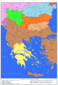
 Balkans1912.jpg 809 × 1,322; 201 KB
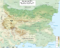
.jpg/120px-Map_of_Bulgaria_(1885).jpg) Map of Bulgaria (1885).jpg 3,932 × 2,425; 2.3 MB
Map of Bulgaria (1885).jpg 3,932 × 2,425; 2.3 MB
 Macedonia 1913 map.png 600 × 449; 60 KB
 1913 Bati Trakya Turk Cumhuriyeti.jpg 550 × 333; 26 KB
 2nd-balkan-war-bulgarian-plan-sr.png 447 × 552; 59 KB
 2nd-balkan-war-bulgarian-plan.JPG 447 × 552; 112 KB
 2nd-balkan-war-bulgarian-plan.png 447 × 552; 80 KB
 8 primorski Balcan War.jpg 1,527 × 1,251; 924 KB
 Administrative divisions of Eastern Rumelia.PNG 1,083 × 526; 40 KB
 April Uprising.png 1,524 × 953; 660 KB
 AtlBalk1880.jpg 318 × 327; 153 KB
 AtlBalk1890.jpg 318 × 327; 157 KB
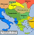
 AtlBalk1914.jpg 318 × 327; 147 KB
 AtlBalk1918.jpg 318 × 327; 160 KB
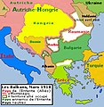
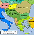 AtlBalk1919.jpg 318 × 327; 151 KB
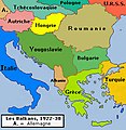 AtlBalk1922-38.jpg 318 × 327; 146 KB
 AtlBalk1940.jpg 318 × 327; 146 KB
 AtlBalk1945-90.jpg 318 × 327; 168 KB
 Balcans - Cambiaments territòriaus en 1912-1913.png 1,257 × 1,221; 392 KB
 Balkan 1912 es.svg 966 × 921; 918 KB
 Balkan 1912 hu.svg 969 × 925; 383 KB
 Balkan 1912.svg 966 × 924; 1.35 MB
 Balkan boundaries1876map1914.png 984 × 712; 73 KB
 Balkan states 1899.jpg 937 × 1,417; 305 KB
 Balkan Wars - Border changes.png 1,005 × 1,022; 119 KB
 Balkan Wars Boundaries cleanup.jpg 1,044 × 1,471; 633 KB
 Balkan Wars Boundaries.jpg 1,026 × 1,454; 571 KB
 Balkans 1912-13.jpg 559 × 600; 327 KB
 Balkans 1913-1918.jpg 559 × 600; 322 KB
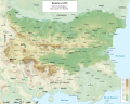
 Balkans at 1905.jpg 1,362 × 2,000; 1.06 MB
 Balkans at 1913.jpg 1,800 × 2,391; 970 KB
 Balkans War Theatre.jpg 4,088 × 3,323; 5.41 MB
 Balkans1878 -1912.jpg 559 × 600; 316 KB
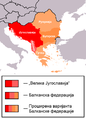 Balkanska federacija.png 613 × 850; 30 KB
 Battle of Kresna Map.png 1,079 × 758; 1.2 MB
 Bałkany 1912.svg 969 × 925; 380 KB
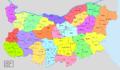 BG Okolii.png 1,589 × 925; 115 KB
 Bulgaria ,after balkan wars 1913-es.svg 2,256 × 1,800; 2.76 MB
 Bulgaria 1915-1918.jpg 869 × 652; 452 KB
 Bulgaria after Congress of Berlin in 1878.png 4,148 × 2,896; 552 KB
 Bulgaria after Treatry of Neuilly-sur-Seine-2.png 3,574 × 3,201; 693 KB
 Bulgaria after Treatry of Neuilly-sur-Seine-ar.png 654 × 600; 122 KB
 Bulgaria after Treatry of Neuilly-sur-Seine-HE.png 654 × 600; 130 KB
 Bulgaria after Treatry of Neuilly-sur-Seine.png 654 × 600; 134 KB
 Bulgaria after unification political map-bg.svg 2,256 × 1,800; 3.01 MB
 Bulgaria after unification political map-de.svg 1,131 × 904; 2.43 MB
 Bulgaria after unification political map-en.svg 2,256 × 1,800; 3.01 MB
 Bulgaria after unification political map-es.svg 2,256 × 1,800; 3.77 MB
 Bulgaria before Balkans Wars.jpg 469 × 369; 52 KB
 Bulgaria dopo Berlin Congress.png 559 × 375; 31 KB
 Bulgaria dopo la conferenza di Costantinopoli.png 1,165 × 853; 106 KB
 Bulgaria dopo Santo Stefano.png 700 × 508; 63 KB
 Bulgaria during World War I.png 1,645 × 1,244; 1.1 MB
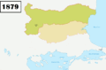
 Bulgaria in 1879 geographic map-bg.svg 2,256 × 1,800; 15.78 MB
 Bulgaria in 1879 geographic map-es.svg 2,256 × 1,800; 16.57 MB
 Bulgaria in 1885 geographic map-bg.svg 2,256 × 1,800; 15.14 MB
 Bulgaria in 1885 geographic map-es.svg 2,256 × 1,800; 15.86 MB
 Bulgaria in 1913 geographic map-bg.svg 2,256 × 1,800; 14.54 MB
 Bulgaria in 1913 geographic map-es.svg 2,256 × 1,800; 15.19 MB
 Bulgaria in 1915 geographic map-bg.svg 2,256 × 1,800; 14.5 MB
 Bulgaria in 1915 geographic map-en.svg 2,256 × 1,800; 14.48 MB
 Bulgaria in 1915 geographic map-es.svg 2,256 × 1,800; 14.43 MB
 Bulgaria in 1919 geographic map-bg.svg 2,256 × 1,800; 14.67 MB
 Bulgaria in 1919 geographic map-es.svg 2,256 × 1,800; 15.48 MB
 Bulgaria in war.PNG 208 × 197; 114 KB
 Bulgaria San Stefano Berlin 1878 1885 TB.png 1,765 × 1,703; 440 KB
 Bulgaria San Stefano Berlin 1878 TB He.png 1,765 × 1,703; 376 KB
 Bulgaria San Stefano Berlin 1878 TB.png 1,765 × 1,703; 449 KB
 Bulgaria trattato di Neuilly.png 570 × 523; 27 KB
 Bulgaria, after balkan wars 1913.svg 2,256 × 1,800; 2.13 MB
 Bulgaria-Boris-III.png 2,621 × 2,086; 34 KB
 Bulgaria-Constantinople-Conference.png 3,677 × 2,614; 52 KB
 Bulgaria-Ferdinand-I.png 2,641 × 2,031; 34 KB
 Bulgaria-San Stefano-Berlin 1878.jpg 786 × 613; 101 KB
-byTodorBozhinov.png/120px-Bulgaria-SanStefano_-(1878)-byTodorBozhinov.png) Bulgaria-SanStefano -(1878)-byTodorBozhinov.png 776 × 605; 176 KB
Bulgaria-SanStefano -(1878)-byTodorBozhinov.png 776 × 605; 176 KB
 Bulgaria-SanStefano-Congress of Berlin-1878.PNG 786 × 613; 423 KB
 BulgariaComienzosSigloXX.svg 1,051 × 998; 1.27 MB
 Bulgarian acquisitions, treaty IX 1915-es.svg 1,085 × 1,675; 224 KB
 Bulgarian acquisitions, treaty IX 1915-fr.svg 1,085 × 1,675; 76 KB
 Bulgarian acquisitions, treaty IX 1915.jpg 1,085 × 1,675; 496 KB
.png/120px-Bulgarian_culture_(1918-1939).png) Bulgarian culture (1918-1939).png 1,794 × 1,276; 666 KB
Bulgarian culture (1918-1939).png 1,794 × 1,276; 666 KB
 Bulgarian Exarchate.png 2,494 × 1,754; 791 KB
 Bulgarian National Revival.png 1,417 × 1,069; 772 KB
- Bulgarian national revolutionary movement in Macedonia and East Thrace (1893-1912).png 1,648 × 1,132; 960 KB
 Bulgarian unification and Serbo-Bulgarian War.png 1,407 × 1,030; 1.44 MB
 Bulgarian-Exarchate-1870-1913.jpg 1,576 × 1,580; 2.13 MB
.png/120px-Bulgarien_1878_(de).png) Bulgarien 1878 (de).png 1,160 × 900; 289 KB
Bulgarien 1878 (de).png 1,160 × 900; 289 KB
 Bulgária 1885.gif 536 × 472; 9 KB
 Bulgária 1913.gif 537 × 470; 11 KB
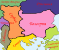
 Bulgária és a környező országok 1877.gif 536 × 472; 7 KB
 Bulgária és a környező országok 1878.gif 536 × 472; 10 KB
 Bulgária és a környező országok 1879.gif 536 × 472; 10 KB
.svg/83px-Campagne_de_Serbie_(1915).svg.png) Campagne de Serbie (1915).svg 800 × 1,150; 160 KB
Campagne de Serbie (1915).svg 800 × 1,150; 160 KB
 Carte position des troupes par nationalité.jpg 933 × 386; 186 KB
 ConferenciaDeConstantinopla1876-1877.svg 2,620 × 1,867; 230 KB
 Constantinople conference.png 3,741 × 2,612; 505 KB
 Europe 1878 map de.png 2,284 × 1,503; 1.01 MB
 Europe 1878 map en.png 2,284 × 1,503; 1.01 MB
 First Balkan war - liberated territories 1913.png 1,204 × 1,191; 666 KB
 First Balkan war - London Treaty negotiations 1912-13.jpg 2,489 × 1,738; 871 KB
 First Balkan War-hu.svg 347 × 313; 633 KB
 First Balkan War-tr.svg 347 × 313; 637 KB
 First Balkan War.SVG 347 × 313; 595 KB
 FR-WW1-1916-French-plans.png 3,223 × 2,324; 203 KB
 Front d'Orient et Serbie en juillet 1916.svg 800 × 1,150; 143 KB
 FronterasDeBulgariaSegúnSanStefanoYBerlín1878.svg 781 × 606; 936 KB
 Gjg.JPG 921 × 1,645; 214 KB
 GuerrasBalcánicasLondresYBucarest.svg 1,027 × 1,242; 901 KB
 GuerrasBalcánicasLondresYBucarest2 de.svg 965 × 1,455; 1,008 KB
 GuerrasBalcánicasSituaciónPrebélica1912.svg 1,027 × 1,242; 888 KB
 Guerre balcaniche.png 1,044 × 1,578; 185 KB
 Guerres balkaniques - situation avant 1912.png 1,044 × 731; 65 KB
 Guerres balkaniques après traité de Bucarest.png 1,044 × 724; 100 KB
 Hellenism in the Near East 1918.jpg 1,403 × 1,721; 862 KB
 Histdob.png 988 × 785; 179 KB
 I balcani nel 1905.png 1,362 × 2,000; 932 KB
 Industry of People's Republic of Bulgaria.png 1,646 × 1,270; 946 KB
 Itоgi Vtoroy Balkanskoy voini.png 350 × 300; 113 KB
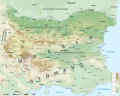
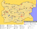
 Karta2.gif 1,301 × 855; 1.01 MB
.svg/118px-Kingdom_of_Bulgaria_(1914).svg.png) Kingdom of Bulgaria (1914).svg 450 × 456; 456 KB
Kingdom of Bulgaria (1914).svg 450 × 456; 456 KB
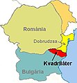 Kvadriláter.jpg 277 × 300; 12 KB
 LocationPeoplesRepublicofBulgaria1988.png 990 × 497; 108 KB
 LPDF 125 14 carte.jpg 941 × 581; 217 KB
 LPDF 61 5 carte 16 XII 1915.jpg 368 × 419; 145 KB
 LPDF 61 6 carte Babouna 16 déc 1915.jpg 379 × 295; 123 KB
 LPDF 63 5 déploiement des Alliés.jpg 703 × 441; 158 KB
 LPDF 98 15 carte du 31 août 1916.jpg 962 × 639; 217 KB
 Map Battle Simitli 1079 1378.jpeg 996 × 996; 276 KB
 Map of Bulgaria after Treaty of Neuilly-sur-Seine Kula region.svg 1,200 × 1,363; 695 KB
 Map of Bulgaria after Treaty of Neuilly-sur-Seine Western Thrace.png 1,280 × 999; 1.3 MB
.jpg/120px-Map_of_the_Balkan_States_(Miller%2c_William%2c_1896).jpg) Map of the Balkan States (Miller, William, 1896).jpg 1,238 × 966; 433 KB
Map of the Balkan States (Miller, William, 1896).jpg 1,238 × 966; 433 KB
 Map of the First Balkan War.png 1,689 × 1,185; 775 KB
 MapaDeDobrudjaTratadoDeBucarest1918.svg 1,269 × 811; 294 KB
 MapaHistóricoDeDobrudja.svg 1,628 × 811; 92 KB
_(14773848065).jpg/120px-Medi%c3%a6val_and_modern_history_(1920)_(14773848065).jpg) Mediæval and modern history (1920) (14773848065).jpg 2,208 × 1,452; 771 KB
Mediæval and modern history (1920) (14773848065).jpg 2,208 × 1,452; 771 KB
 Oblasti de Bulgarie 1987-1999.png 548 × 361; 22 KB
 Operations at the border of Greece and Serbia during WW1.jpg 1,242 × 961; 252 KB
 OttomanCession1915.png 620 × 827; 10 KB
 Povlacenje srpske vojske u PSR es.svg 806 × 930; 286 KB
 Povlacenje srpske vojske u PSR mk.svg 806 × 930; 171 KB
 Prima guerra balcanica.bg.png 1,005 × 1,022; 127 KB
.svg/118px-Principality_of_Bulgaria_(1890).svg.png) Principality of Bulgaria (1890).svg 450 × 456; 437 KB
Principality of Bulgaria (1890).svg 450 × 456; 437 KB
 Protocol of Saint Petersburg 1913 map.png 1,739 × 1,067; 66 KB
 Results of the Treaty of Berlin 1878..jpg 5,120 × 7,352; 11.92 MB
 Romania-WW1-1.jpg 1,036 × 862; 149 KB
 Romania-WW1-2.jpg 974 × 898; 159 KB
 Romania-WW1-3.jpg 1,018 × 868; 159 KB
 Rumelia orientale.png 452 × 298; 25 KB
 SanStefano1.jpg 1,004 × 768; 58 KB
 SanStefanoBalkan.jpg 1,112 × 857; 410 KB
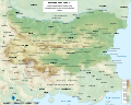
 Sanstefanska Bulgaria.png 3,791 × 2,647; 1.9 MB
 Second Balkan War-es.svg 4,387 × 2,899; 1,009 KB
 Second Balkan War.png 1,710 × 1,371; 848 KB
 Serbia-WW1-3.jpg 868 × 918; 220 KB
- Serbo-Bulgarian War. Counteroffensive of the Bulgarian Army (22-27.XI.1885).png 2,682 × 1,866; 1.69 MB
 Tamrashka republika en.png 640 × 423; 65 KB
 Tamrashka republika es.svg 5,088 × 2,394; 336 KB
 Tamrashka republika.png 610 × 399; 48 KB
 Territorial aspirations of the Balkan states, 1912.jpg 969 × 770; 648 KB
- Territorial Modifications in the Balkans – Conference of London 1913.JPG 1,026 × 669; 430 KB
 Territories ceded by Bulgaria to SCS Kingdom map.png 1,262 × 2,678; 112 KB
 Territories ceded by Bulgaria to SCS Kingdom.png 335 × 436; 30 KB
 The Balkan boundaries after 1913.jpg 646 × 852; 223 KB
 The Balkans, as per the Treaty of Bucharest of 1913.jpg 976 × 642; 187 KB
 Thrace Territory cession TurkeyBulgaria Oct1915.gif 500 × 657; 14 KB
 Traité de Neuilly-sur-Seine.png 885 × 666; 112 KB
 TratadoDeNeuilly1919.svg 1,121 × 1,065; 611 KB
.png/120px-WandS_Bulgaria_after_Treatry_of_Neuilly-sur-Seine_(Dutch).png) WandS Bulgaria after Treatry of Neuilly-sur-Seine (Dutch).png 564 × 410; 28 KB
WandS Bulgaria after Treatry of Neuilly-sur-Seine (Dutch).png 564 × 410; 28 KB
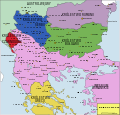
 Zapadne bugarske pokrajine.png 1,779 × 2,079; 253 KB
 Zapadni pokrajnini.png 1,779 × 2,079; 219 KB
 Zapadni Pokrajnini.png 335 × 436; 58 KB
 Α' Βαλκανικός Πόλεμος.SVG 347 × 313; 594 KB
 Β' Βαλκανικός Πόλεμος.SVG 347 × 313; 592 KB
.jpg/120px-%d0%91%d0%be%d0%bb%d0%b3%d0%b0%d1%80%d0%b8%d1%8f_(1885).jpg) Болгария (1885).jpg 2,649 × 1,558; 2.95 MB
Болгария (1885).jpg 2,649 × 1,558; 2.95 MB

.6)