Category:Territorial evolution of Poland
Jump to navigation
Jump to search

Countries of Europe: Belgium · Estonia · Finland · France‡ · Germany · Greece · Italy · Latvia · Lithuania · Luxembourg · Poland · Romania · San Marino · Spain‡ · Switzerland · Ukraine · United Kingdom
‡: partly located in Europe
‡: partly located in Europe
| Upload media | |||
| Instance of | territorial change | ||
|---|---|---|---|
| |||
Subcategories
This category has the following 5 subcategories, out of 5 total.
Media in category "Territorial evolution of Poland"
The following 149 files are in this category, out of 149 total.
 Territorial-changes-of-Poland-1635-2009-improved.gif 550 × 400; 4.11 MB
 Territorial-changes-of-Poland-1635-2009-small.gif 380 × 313; 673 KB
 Territorial-changes-of-Poland-1635-2009.gif 750 × 618; 5.38 MB
 Granice 1793-1921.png 499 × 538; 18 KB
.png/111px-Poland_borders_1793-1921_(uk).png) Poland borders 1793-1921 (uk).png 499 × 538; 15 KB
Poland borders 1793-1921 (uk).png 499 × 538; 15 KB
 Граница 1793-1921.png 499 × 538; 15 KB
 Border changes in history of Poland.png 900 × 742; 323 KB
 Caricature for Riga Peace 1921.png 1,903 × 1,311; 73 KB
 Duchy of Auschwitz border changes.png 800 × 642; 190 KB
 Duchy of Warsaw 1809-1815.PNG 2,295 × 2,275; 420 KB
 Galicja Wschodnia w II RP i III RP.PNG 889 × 892; 39 KB
 Grody w okresie Mieszka I.png 1,600 × 1,529; 707 KB
.png/99px-Gu%c3%a8rra_Sovietopolonesa_(1919-1921).png) Guèrra Sovietopolonesa (1919-1921).png 2,621 × 3,190; 2.35 MB
Guèrra Sovietopolonesa (1919-1921).png 2,621 × 3,190; 2.35 MB
 Irp1569.jpg 2,000 × 1,568; 1.09 MB
 Königsberg 1656.PNG 717 × 515; 39 KB
 Ofensywa na Kijow.png 2,000 × 1,534; 425 KB
 Ofensywa na Warszawe.png 2,000 × 1,534; 356 KB
 Panstwo mieclawa-es.svg 14,016 × 11,345; 5.18 MB
 Panstwo mieclawa.svg 700 × 567; 3.21 MB
 PBW August 1920-es.svg 2,014 × 1,567; 1.33 MB
 PBW August 1920.png 2,000 × 1,534; 343 KB
 PBW December 1919-es.svg 2,014 × 1,567; 1.35 MB
 PBW December 1919.png 2,000 × 1,534; 337 KB
 PBW June 1920-es.svg 2,014 × 1,567; 1.36 MB
 PBW June 1920.png 2,000 × 1,534; 339 KB
 PBW March 1919-es.svg 2,014 × 1,567; 1.3 MB
 PBW March 1919.png 2,000 × 1,534; 347 KB
 PBW March 1919.svg 2,014 × 1,567; 441 KB
 PL-RU war 1919 phase I-es.svg 5,416 × 4,237; 288 KB
 PL-RU war 1919 phase I.svg 5,416 × 4,237; 381 KB
 PL-RU war 1919 phase II de.svg 2,705 × 2,112; 897 KB
 PL-RU war 1919 phase II-es.svg 5,416 × 4,237; 315 KB
 PL-RU war 1919 phase II.svg 5,416 × 4,237; 411 KB
 PL-RU war 1919 phase III-es.svg 5,416 × 4,237; 297 KB
 PL-RU war 1919 phase III.svg 5,416 × 4,237; 392 KB
 Plebiscyt+Cieszy+Spisz+Orawa.PNG 2,000 × 1,281; 554 KB
 PLRUM1919.png 338 × 258; 7 KB
 Polen 960-992.png 2,309 × 2,279; 1.08 MB
 Polish-Lithuanian Commonwealth 1582-es.svg 1,408 × 1,118; 1.18 MB
 Polish-Lithuanian Commonwealth 1582.PNG 1,992 × 1,564; 708 KB
 Polish-Lithuanian Commonwealth at its maximum extent-es.svg 1,410 × 1,109; 147 KB
 Polish-Lithuanian Commonwealth at its maximum extent.svg 1,410 × 1,109; 197 KB
 Polish-Lithuanian Commonwealth in 1648-es.svg 1,406 × 1,124; 1.5 MB
 Polish-Lithuanian Commonwealth in 1648.PNG 2,000 × 1,568; 804 KB
 Polonha - Cambiaments territòriaus de Polonha en 1945.png 1,251 × 1,221; 207 KB
 Polska 1333 - 1370-es.svg 2,962 × 2,817; 3.76 MB
 Polska 1333 - 1370.png 2,636 × 2,507; 1.28 MB
 Polska 1370 - 1382-es.svg 2,962 × 2,817; 3.62 MB
 Polska 1370 - 1382.png 2,636 × 2,507; 1.94 MB
 Polska 1386 - 1434.png 2,977 × 2,929; 2.14 MB
 Polska 960 - 992-es.svg 11,510 × 11,360; 2.5 MB
 Polska 960 - 992.png 1,854 × 1,828; 1.45 MB
 Polska 960 - 992.svg 11,510 × 11,360; 2.37 MB
 Polska 992 - 1025-es.svg 11,510 × 11,360; 2.55 MB
 Polska 992 - 1025-pt.svg 12,277 × 12,117; 2.19 MB
 Polska 992 - 1025.png 4,215 × 3,780; 4.17 MB
 Polska around 1000.png 2,309 × 2,279; 1.41 MB
 Polska 992 - 1025.svg 1,500 × 1,480; 2.38 MB
 Polska Boleslaw 1386 - 1434.png 1,024 × 1,007; 849 KB
_es.svg/120px-Polska_WladLokietka_(1275-1300)_es.svg.png) Polska WladLokietka (1275-1300) es.svg 1,187 × 1,039; 1.55 MB
Polska WladLokietka (1275-1300) es.svg 1,187 × 1,039; 1.55 MB
_hu.svg/120px-Polska_WladLokietka_(1275-1300)_hu.svg.png) Polska WladLokietka (1275-1300) hu.svg 1,187 × 1,039; 1.42 MB
Polska WladLokietka (1275-1300) hu.svg 1,187 × 1,039; 1.42 MB
.png/120px-Polska_WladLokietka_(1275-1300).png) Polska WladLokietka (1275-1300).png 1,187 × 1,039; 223 KB
Polska WladLokietka (1275-1300).png 1,187 × 1,039; 223 KB
 Prussia during the Second Northern War upright.PNG 716 × 1,620; 125 KB
 Prussia during the Second Northern War--1654-es.svg 506 × 365; 556 KB
 Prussia during the Second Northern War--Königsberg1656-es.svg 506 × 365; 605 KB
 Prussia during the Second Northern War--Labiau1656-es.svg 506 × 365; 555 KB
 Prussia during the Second Northern War--Wehlau-Bromberg1657-es.svg 506 × 365; 561 KB
 Prussia during the Second Northern War.PNG 1,444 × 1,042; 123 KB
 Prussia during the Second Northern War.png 1,081 × 1,040; 112 KB
 RepúblicaDeLasDosNaciones1569-es.svg 1,408 × 1,122; 1.24 MB
 Rzeczpospolita 1789-1920.png 2,000 × 1,534; 230 KB
 Rzeczpospolita 1920 claims names.png 2,000 × 1,534; 359 KB
 Rzeczpospolita 1922.png 2,000 × 1,534; 346 KB
 Rzeczpospolita de.png 2,000 × 1,568; 326 KB
 Rzeczpospolita Rozbiory 1.png 2,000 × 1,568; 234 KB
 Rzeczpospolita Rozbiory 2.png 1,902 × 1,568; 296 KB
 Rzeczpospolita-HE.png 2,000 × 1,568; 282 KB
 Rzeczpospolita.png 2,000 × 1,568; 332 KB
 Sopoćkińskie 1.png 298 × 531; 465 KB
 Sopoćkińskie.jpg 296 × 531; 132 KB
 Suwalszczyzna Sopćkińska.jpg 741 × 879; 60 KB
 Territorial changes of Poland 1635.jpg 850 × 700; 296 KB
 Territorial changes of Poland 1645.jpg 850 × 700; 264 KB
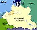 Territorial changes of Poland 1653.jpg 850 × 700; 258 KB
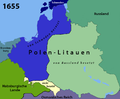 Territorial changes of Poland 1655-de.png 850 × 700; 158 KB
 Territorial changes of Poland 1655-es.svg 1,409 × 1,124; 1.29 MB
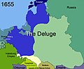 Territorial changes of Poland 1655.jpg 850 × 700; 235 KB
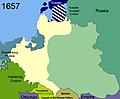 Territorial changes of Poland 1657.jpg 850 × 700; 243 KB
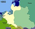 Territorial changes of Poland 1660.jpg 850 × 700; 201 KB
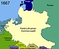 Territorial changes of Poland 1667.jpg 850 × 700; 239 KB
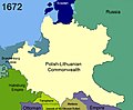 Territorial changes of Poland 1672.jpg 850 × 700; 245 KB
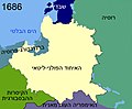 Territorial changes of Poland 1686-HE.jpg 850 × 700; 185 KB
 Territorial changes of Poland 1686.jpg 850 × 700; 239 KB
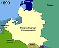 Territorial changes of Poland 1699.jpg 850 × 700; 217 KB
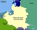 Territorial changes of Poland 1701.jpg 850 × 700; 199 KB
 Territorial changes of Poland 1713.jpg 850 × 700; 199 KB
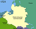 Territorial changes of Poland 1721.jpg 850 × 700; 194 KB
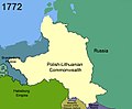 Territorial changes of Poland 1772.jpg 850 × 700; 200 KB
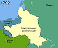 Territorial changes of Poland 1792.jpg 850 × 700; 181 KB
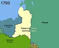 Territorial changes of Poland 1793.jpg 850 × 700; 184 KB
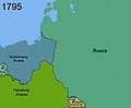 Territorial changes of Poland 1795.jpg 850 × 700; 153 KB
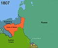 Territorial changes of Poland 1807.jpg 850 × 700; 179 KB
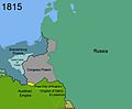 Territorial changes of Poland 1815.jpg 850 × 700; 178 KB
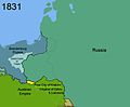 Territorial changes of Poland 1831.jpg 850 × 700; 174 KB
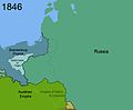 Territorial changes of Poland 1846.jpg 850 × 700; 166 KB
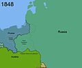 Territorial changes of Poland 1848.jpg 850 × 700; 156 KB
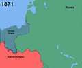 Territorial changes of Poland 1871.jpg 850 × 700; 136 KB
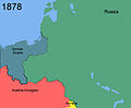 Territorial changes of Poland 1878.jpg 850 × 700; 141 KB
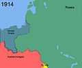 Territorial changes of Poland 1914.jpg 850 × 700; 139 KB
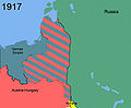 Territorial changes of Poland 1917.jpg 850 × 700; 205 KB
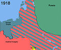 Territorial changes of Poland 1918.jpg 850 × 700; 305 KB
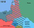 Territorial changes of Poland 1918b.jpg 850 × 700; 318 KB
 Territorial changes of Poland 1919.jpg 850 × 700; 375 KB
 Territorial changes of Poland 1919b.jpg 850 × 700; 302 KB
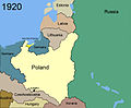
 Territorial changes of Poland 1920.jpg 850 × 700; 253 KB
 Territorial changes of Poland 1920b.jpg 850 × 700; 258 KB
 Territorial changes of Poland 1920c.jpg 850 × 700; 214 KB
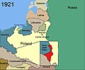 Territorial changes of Poland 1921.jpg 850 × 700; 77 KB
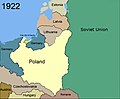 Territorial changes of Poland 1922.jpg 850 × 700; 67 KB
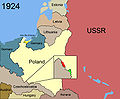 Territorial changes of Poland 1924.jpg 850 × 700; 235 KB
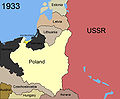 Territorial changes of Poland 1933.jpg 850 × 700; 214 KB
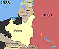 Territorial changes of Poland 1938.jpg 850 × 700; 207 KB
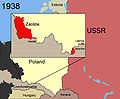 Territorial changes of Poland 1938c.jpg 850 × 700; 218 KB
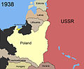 Territorial changes of Poland 1938d.jpg 850 × 700; 205 KB
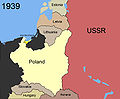 Territorial changes of Poland 1939.jpg 850 × 700; 199 KB
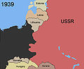 Territorial changes of Poland 1939b.jpg 850 × 700; 171 KB
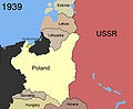 Territorial changes of Poland 1939c.jpg 850 × 700; 197 KB
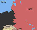 Territorial changes of Poland 1940.jpg 850 × 700; 147 KB
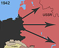 Territorial changes of Poland 1942.jpg 850 × 700; 188 KB
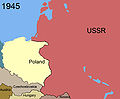 Territorial changes of Poland 1945.jpg 850 × 700; 169 KB
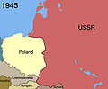 Territorial changes of Poland 1945b.jpg 850 × 700; 167 KB
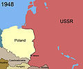 Territorial changes of Poland 1948.jpg 850 × 700; 170 KB
 Territorial changes of Poland 1948a.jpg 785 × 589; 136 KB
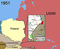 Territorial changes of Poland 1951.jpg 850 × 700; 264 KB
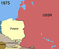 Territorial changes of Poland 1975.jpg 850 × 700; 172 KB
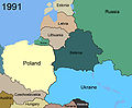 Territorial changes of Poland 1991.jpg 850 × 700; 216 KB
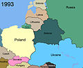 Territorial changes of Poland 1993.jpg 850 × 700; 221 KB
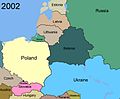 Territorial changes of Poland 2002.jpg 850 × 700; 229 KB
 Truce of Andrusovo 1667-es.svg 1,407 × 1,119; 1.42 MB
 Truce of Andrusovo 1667.PNG 2,000 × 1,568; 1,023 KB
 Truce of Andrusovo Ukraine 1667.png 1,043 × 810; 227 KB
 Truce of Deulino 1618-1619-es.svg 1,500 × 1,193; 6.13 MB
 Truce of Deulino 1618-1619.PNG 2,000 × 1,568; 747 KB
 Truce of Jam Zapolski 1582-es.svg 1,408 × 1,118; 1.2 MB
 Truce of Jam Zapolski 1582.PNG 2,000 × 1,568; 711 KB
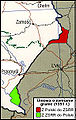 Umowa o zamianie granic 1951.jpg 191 × 302; 88 KB
 Wojna polsko-rosyjska 1654-1667.PNG 2,000 × 1,568; 853 KB
 Ziemie Czernihowsko-Siewierskie w XV wieku.jpg 4,384 × 4,189; 4.47 MB
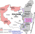 Échanges de populations Pologne-Ukraine.png 487 × 466; 152 KB