Atlas of Russia
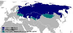
Specific status: Akrotiri and Dhekelia‡ · Faroe Islands · Gibraltar · Guernsey · Isle of Man · Jersey – Limited recognition: Abkhazia‡ · Republic of Artsakh‡ · Gagauzia · Kosovo · South Ossetia‡ · Transnistria · Turkish Republic of Northern Cyprus‡
‡: partly located in Europe

|
Wikimedia Commons Atlas of the World The Wikimedia Atlas of the World is an organized and commented collection of geographical, political and historical maps available at Wikimedia Commons. Discussion • Update the atlas • Index of the Atlas • Atlas in categories • Other atlases on line |
|
| ||||||||||||||||||||||||||||||||||||||||
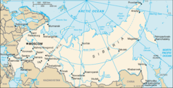
_-_RUS_-_UNOCHA.svg/200px-Russia_-_Location_Map_(2013)_-_RUS_-_UNOCHA.svg.png)
General maps
_-_/251px-Russian_Federation_(orthographic_projection)_-_Crimea_disputed.svg.45d4.delay)
|
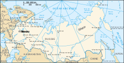
Russia |
|
Map of Russia |
|
Blank SVG map |
|
SVG map in french |
|
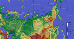
Topographic map |
Maps of divisions
This section holds maps of the administrative divisions.
Federal subjects of the Russian Federation:
Republics: Adygea · Altai · Altai · Bashkortostan · Buryatia · Chechnya · Chuvashia · (Crimea) · Dagestan · Ingushetia · Kabardino-Balkaria · Kalmykia · Karachay–Cherkessia · Khakassia · Komi · Mari El · Mordovia · North Ossetia — Alania · Tatarstan · UdmurtiaKrais:
Oblasts:
Federal cities:
Autonomous oblast:
Autonomous okrugs:
.svg/251px-Map_of_federal_subjects_of_Russia_(2014).svg.png)
|
Federal subjects of theRussian Federation |
|
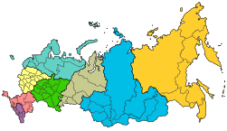
Federal districts of the Russian Federation |
|
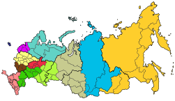
Economic regions of the Russian Federation |
|
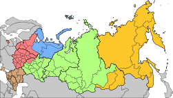
Military districts of the Russian Federation |
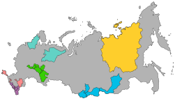
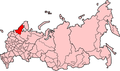
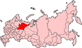
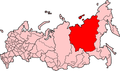
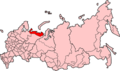
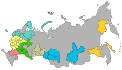
Republics of Russia
|
Republics of the Russian Federation |
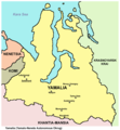
Map of Adygea(Республика Адыгея / Адыгэ Республик)
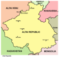
Altai
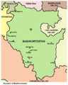
Map of Bashkortostan

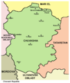
Map of Buryatia
Map of Buryatia
Map of Chechnya
Map of Chuvashia (Чувашская Республика/Чăваш Республики)

Crimea

Crimea
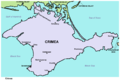
Crimea

Map of Dagestan (Республика Дагестан)
Map of Ingushetia (Республика Ингушетия/ГIалгIай Мохк)
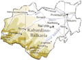
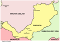
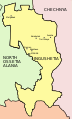
Map of Kabardino-Balkaria (Кабардино-Балкарская Республика/Къэбэрдей-Балъкъэр Республикэ/Къабарты-Малкъар Республика
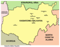
Map of Kabardino-Balkaria (Кабардино-Балкарская Республика/Къэбэрдей-Балъкъэр Республикэ/Къабарты-Малкъар Республика
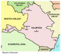
Map of Kalmykia (Республика Калмыкия/Хальмг Таңһч}

Map of Karachay-Cherkessia (Карачаево-Черкесская Республика/Къарачай-Черкес Республика/Къэрэшей-Шэрджэс Республикэ)

Map of Karelia

Map of Karelia (Республика Карелия/Karjalan Tazavalla)
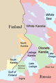
Map of Karelia
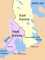
Map of Karelia
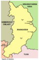
Khakassia
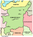
Map of Komi (Республика Коми/Коми Республика}
Map of Mari El (Республика Марий Эл/Марий Эл Республика}

Map of Mordovia (Республика Мордовия/Мордовскяй Республикась)
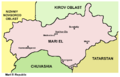
Map of North Ossetia-Alania (Республика Северная Осетия-Алания/Цӕгат Ирыстоны Аланийы Республикӕ)
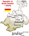
Map of North Ossetia-Alania
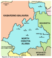
Map of North Ossetia-Alania and wider Ossetia region
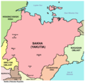
Sakha (Yakutia)
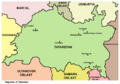
Map of Tatarstan (Республика Татарстан/Татарстан Республикасы )
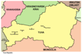
Tuva
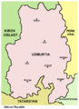
Map of Udmurtia (Удмуртская республика/Удмурт Элькун}
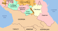
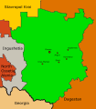
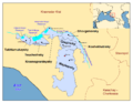
Map of Northern Caucasus
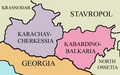
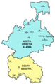
Map of Karachay-Cherkessia and Kabardino-Balkaria

Adygea

Altai

Buryatia

Chechnya

Chuvashia

Dagestan

Ingushetia
Kabardino-Balkaria
Kalmykia

Karachay-Cherkessia
Karelia
Khakassia
Komi

Mari El

Mordovia
North Ossetia-Alania
Sakha
Tatarstan

Tuva
Udmurtia
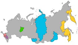
Autonomous Okrugs of Russia
|
Autonomuc Okrugs of the Russian Federation |
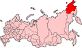
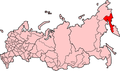
Chukotka
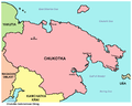
Chukotka

Khantia-Mansia

Khantia-Mansia
Nenetsia

Nenetsia
Yamalia
Yamalia
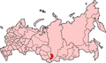
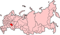
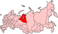
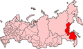
Krais of Russia
|
Krais of the Russian Federation |
Altai Krai
Khabarovsk Krai
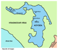
Krasnodar Krai
Krasnoyarsk Krai

Perm Krai
Primorsky Krai
Stavropol Krai
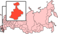
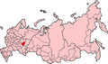
Oblasts of Russia
|
Русский: Области России English: Oblasts of the Russian Federation
|
 Русский: Амурская областьEnglish: Amur Oblast
 Русский: Архангельская областьEnglish: Arkhangelsk Oblast
 Русский: Астраханская областьEnglish: Astrakhan Oblast
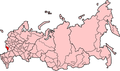 Русский: Белгородская областьEnglish: Belgorod Oblast
 Русский: Брянская областьEnglish: Bryansk Oblast
 Русский: Челябинская областьEnglish: Chelyabinsk Oblast
 Русский: Читинская областьEnglish: Chita oblast
 Русский: Иркутская областьEnglish: Irkutsk Oblast
 Русский: Ивановская областьEnglish: Ivanovo Oblast
 Русский: Калининградская областьEnglish: Kaliningrad Oblast
 Русский: Калужская областьEnglish: Kaluga Oblast
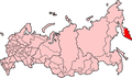 Русский: Камчатская областьEnglish: Kamchatka Oblast
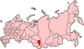 Русский: Кемеровская областьEnglish: Kemerovo Oblast
 Русский: Кировская областьEnglish: Kirov Oblast
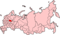 Русский: Костромская областьEnglish: Kostroma Oblast
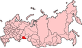 Русский: Курганская областьEnglish: Kurgan Oblast
 Русский: Курская областьEnglish: Kursk Oblast
 Русский: Ленингра?дская о?бластьEnglish: Leningrad Oblast
 Русский: Липецкая областьEnglish: Lipetsk Oblast
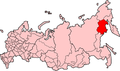 Русский: Магаданская областьEnglish: Magadan Oblast
 Русский: Московская областьEnglish: Moscow Oblast
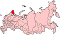 Русский: Мурманская областьEnglish: Murmansk Oblast
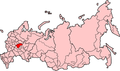 Русский: Нижегородская областьEnglish: Nizhny Novgorod Oblast
 Русский: Новгородская областьEnglish: Novgorod Oblast
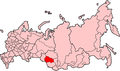 Русский: Новосибирская областьEnglish: Novosibirsk Oblast
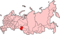 Русский: Омская областьEnglish: Omsk Oblast
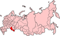 Русский: Оренбургская областьEnglish: Orenburg Oblast
 Русский: Орловская областьEnglish: Oryol Oblast
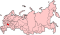 Русский: Пензенская областьEnglish: Penza Oblast
 Русский: Псковская областьEnglish: Pskov Oblast
 Русский: Ростовская областьEnglish: Rostov Oblast
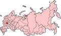 Русский: Рязанская областьEnglish: Ryazan Oblast
 Русский: Сахалинская областьEnglish: Sakhalin Oblast
 Русский: Самарская областьEnglish: Samara Oblast
 Русский: Саратовская областьEnglish: Saratov Oblast
 Русский: Смоленская областьEnglish: Smolensk Oblast
 Русский: Свердловская областьEnglish: Sverdlovsk Oblast
 Русский: Тамбовская областьEnglish: Tambov Oblast
 Русский: Томская областьEnglish: Tomsk Oblast
 Русский: Тверская областьEnglish: Tver Oblast
 Русский: Тульская областьEnglish: Tula Oblast
 Русский: Тюменская областьEnglish: Tyumen OblastEsperanto: Tjumenja provinco
 Русский: Ульяновская областьEnglish: Ulyanovsk Oblast
 Русский: Владимирская областьEnglish: Vladimir Oblast
 Русский: Волгоградская областьEnglish: Volgograd Oblast
 Русский: Вологодская областьEnglish: Vologda Oblast
 Русский: Воронежская областьEnglish: Voronezh Oblast
 Русский: Ярославская областьEnglish: Yaroslavl Oblast
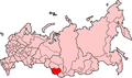
Autonomous oblast of Russia
|
Autonomous oblast of the Russian Federation |
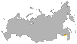
 Русский: Еврейская автономная областьEnglish: Jewish Autonomous Oblast
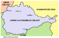
Map of Jewish Autonomous Oblast
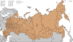
Raions of Russia
 Русский: Респу́блика Адыге́я районEnglish: Administrative divisions of Adygea
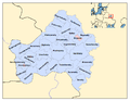 Русский: Бря́нская о́бласть район
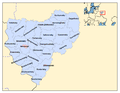 Русский: Смол́енская о́бласть район
 Русский: Белгоро́дская о́бласть район
History maps
This section holds a short summary of the history of the area of present-day Russia, illustrated with maps, including historical maps of former countries and empires that included present-day Russia.
General history
|
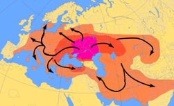
Kurgan hypothesis: South Russia and Eastern Ukraine as the urheimat of Indo-European peoples |
|
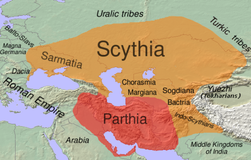
Map of Scythia 100 BC |
|
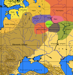
An approximative map of the cultures in European Russia at the arrival of the Varangians |
|
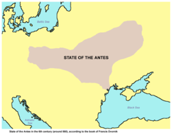
State of the Antes in the 6th century (around 560), according to the book of Francis Dvornik |
|
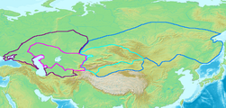
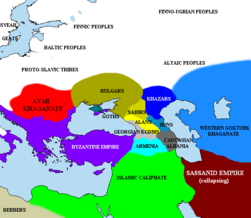
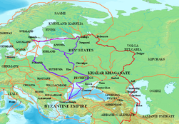
Map of the Western (purple) and Eastern (blue) Gokturk khaganates at their height, c. 600 CE. Lighter areas show direct rule; darker areas show spheres of influence. |
|
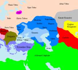
Development of Khazaria |
|
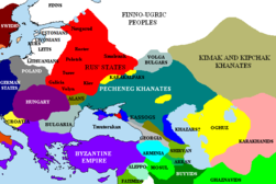
| [[|border|251x400px]] | Fall of Khazaria and rise of Kievan Rus |
|
|
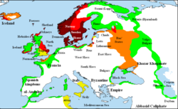
Map showing Scandinavian settlement in the eighth (dark red), ninth (red), tenth (orange) and eleventh (yellow) centuries. Areas denoted in green are those affected by frequent viking incursions but with little or no Scandinavian settlement. |
|
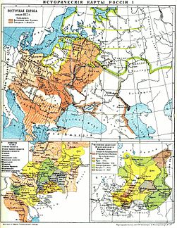
Russia 9th-14th Century (Russian) |
|
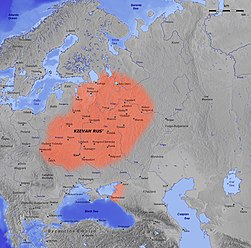
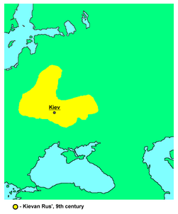
Kievan Rus' was formed around 884 in an area that comprises now parts of Ukraine, Belarus and Russia. |
|
|
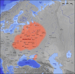
Early Rus' |
|
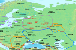
Varangian routes |
|
Kievan Rus 9th Century |
|
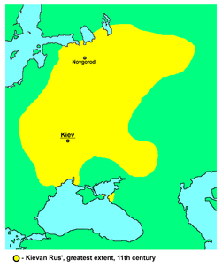
Kievan Rus 11th Century |
|
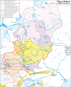
Kievan Rus 1015-1113(in Russian) |
|
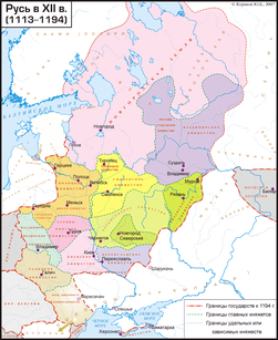
Kievan Rus 1113-1194 (in Russian) |
|
|
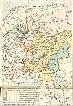
Various states in Russia (in Russian) |
|
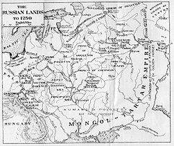
Various states in Russia around 1250 |
|
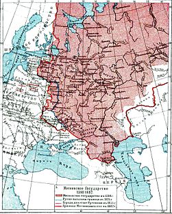
Development of Muscovy (in German) |
|
Development of Muscovy (in Russian) |
|
|
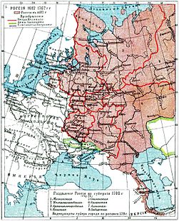
Russia 1598-1682 (Russian) |
|
Russia 1682-1762 (Russian) |
|
The Russian Empire in 1866 (including Alaska) |
|
The Russian Empire in 1914 |
|
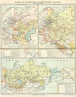
History of the Russian Empire (in German) |
|
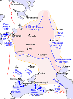
Russian Civil War |
|
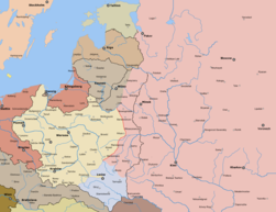
Polish-Bolshevik War March 1919 |
|
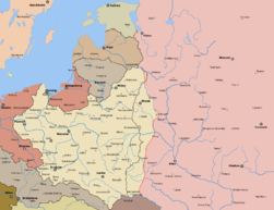
December 1919 |
|
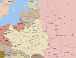
June 1920 |
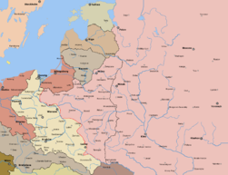
|
August 1920 |
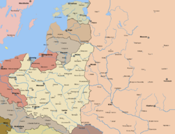
|
Borders after treaty of Riga |
|
After the Russian Revolution, the former Russian Empire was continued by the Soviet Union. For more maps, see Atlas of the Soviet Union. Russia becomes a separate country again in 1990. |
|
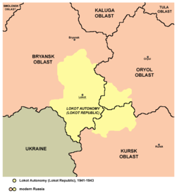
Lokot Autonomy (Lokot Republic) map, 1941-1943 |
|
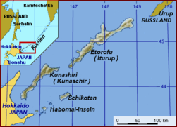
Kuril Islands conflict |
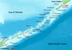
|
Kuril Islands |
Former autonomous subdivisions of Russia
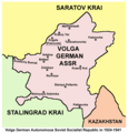
Volga German ASSR, 1924-1941
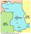
Permyakia (Komi-Permyak Autonomous Okrug) until 2005

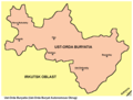
Aga Buryatia
Aga Buryatia
Koryakia
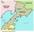
Koryakia

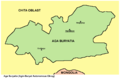
Ust-Orda Buryatia
Ust-Orda Buryatia
Old maps
This section holds copies of original general maps more than 70 years old.
|
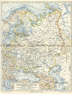
European Russia (in German) |
|
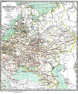
European Russia (in Russian) |
|
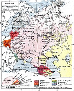
Ethnic map of European Russia (in French) |
|
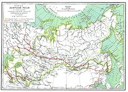
Asiatic Russia (in Russian) |
Other maps
|
Russian language |
|
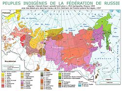
Indigenous peoples (in French) |
|
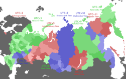
Time zones |
|
Russian licence plates |
|
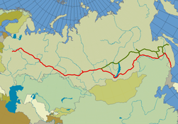
Trans-Siberian railway |
|
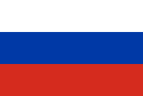
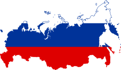
Map of Russia in the colors of the Flag of Russia. |

Moscow - Central Okrug districts
Moscow - Eastern Okrug districts

Moscow - Northern Okrug districts
Moscow - North Eastern Okrug districts
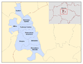
Moscow - North Western Okrug districts

Moscow - Southern Okrug districts
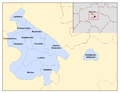
Moscow - South Eastern Okrug districts
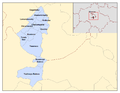
Moscow - South Western Okrug districts
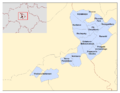
Moscow - Western Okrug districts

City of Zelenograd districts
Notes and references
|
General remarks:
|